Cities worldwide face
various complex environmental, social, economic, and
governance challenges, amplified by ongoing crises such as
the Covid-19 pandemic or consequences of military
conflicts. It is increasingly evident that the
multifaceted nature of these problems requires
comprehensive, holistic approaches instead of attempts to
find solutions that only focus on individual problem
aspects. Ideally, the challenges are tackled by always
aiming at a more sustainable development, i.e., a
development that meets the needs of the present without
compromising the ability of future generations to meet
their own needs. To address the wide range of global
challenges and to promote a more sustainable and equitable
world, the UN Sustainable Development Goals (SDGs) were
developed as part of the 2030 Agenda for Sustainable
Development that was officially adopted by all member
states of the UN in September 2015. They are a set of 17
global, interconnected goals and address a range of
social, economic, and environmental challenges. The role
of the SDGs in promoting more sustainable cities lies in
providing a comprehensive framework for governments,
organizations, and communities to work towards common
objectives.
When aiming to promote a sustainable development, it is critical for any
type of stakeholder to first obtain a clear picture of the situation in the
region of interest. Accordingly, it is necessary to identify associated
indicators for each SDG that provide insights into the status quo or past
developments. And last not least, these indicators can only be examined
properly if data sets with information about them are available and
accessible. Several approaches exist that aim to provide such data-based
information for cities. Yet, these tools are often limited regarding
the data sources used, but above all when it comes to the spatial resolution
of the cities under consideration: they only allow the exploration and
analysis of SDGs on a macro level, usually the complete city. However,
cities are not homogeneous – different quarters vary a lot with regard to
their population, usage, building structure, etc. Even inside of quarters,
social disparities can often be determined. Thus, to accurately identify
existing problems, and to improve living conditions accordingly, an analysis
at macro level is not enough.
In order to examine the potentials and challenges of an approach that
allows spatially differentiated analyses of SDGs within cities, the project
SMEXI (Small Scale Exploration of SDG Indicators) was initiated at
DFKI. Using the city of Kaiserslautern, Germany, as a first test bed, the
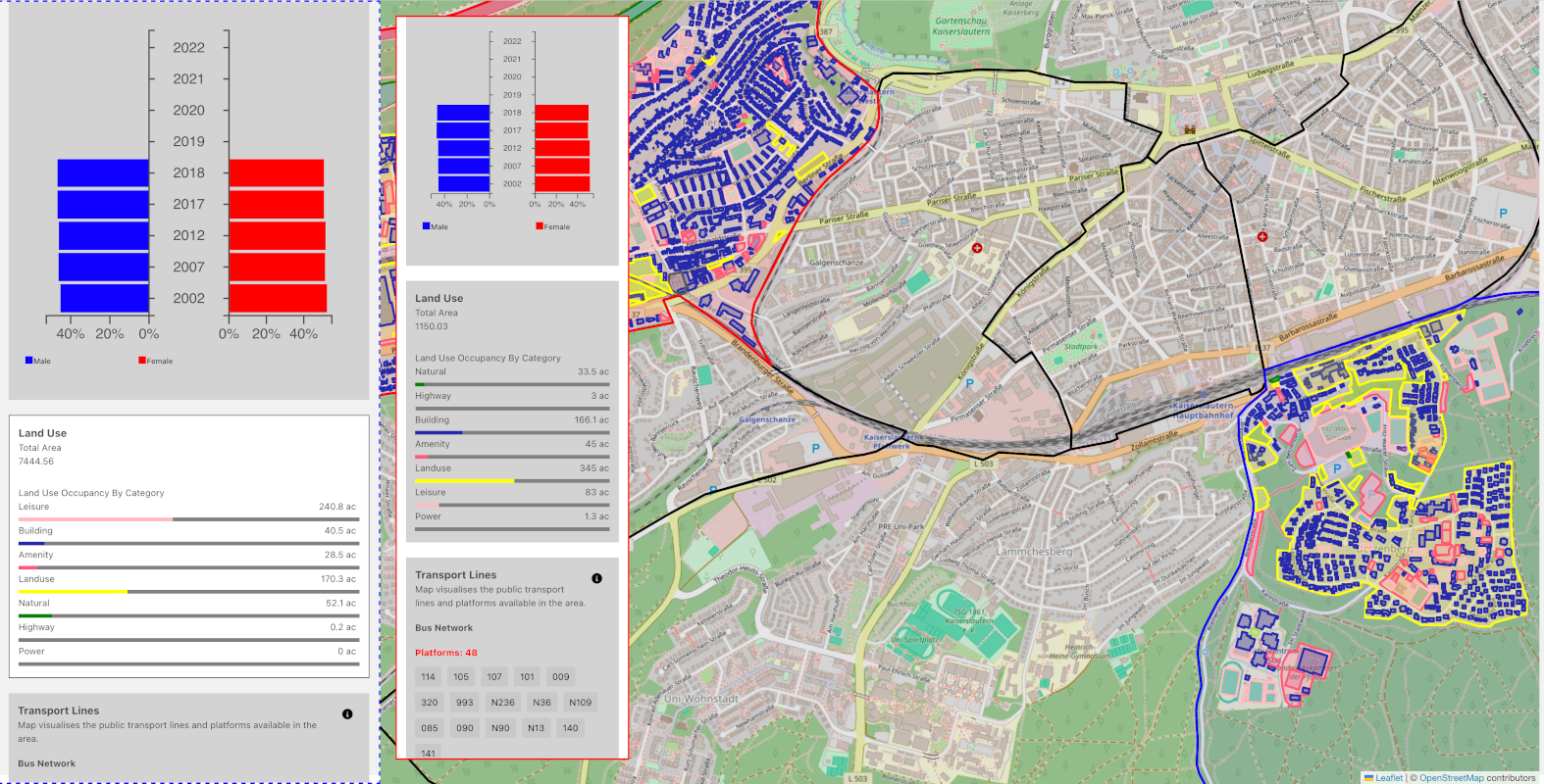
aim was to provide an interactive and adaptable, digital platform
facilitating the tracking of SDGs in cities at a small scale. A first
prototype of the SMEXI system was realized at the end of 2023
from Akhil Yeerasam making use of
various data sets from the city administration of Kaiserslautern and other,
mainly publicly available sources. It is a web-based tool that uses local
districts and statistical districts as spatial units for fine-grained
examinations. It offers means to compare different parts of a city, and to
manually define scores for different SDGs.
In October 2024, SMEXI was published as Open Source.
Our aim is to continue the development of the tool and
to use it in varius sustainability scenarios. We
encourage everyone to make use of SMEXI in their own
city with a focus on their own interests -
don't hesitate to contact us!


